A recent submission by Drs. Emre Ozelkan and Gang Chen has been accepted by the International Journal of Applied Earth Observation and Geoinformation. Congratulations, Emre!
Title: Multiscale object-based drought monitoring and comparison in rainfed and irrigated agriculture from Landsat 8 OLI imagery
Abstract:
Drought is a rapidly rising environmental issue that can cause hardly repaired or unrepaired damages to the nature and socio-economy. This is especially true for a region that features arid/semi-arid climate, including the Turkey’s most important agricultural district – Southeast Anatolia. In this area, we examined the uncertainties of applying Landsat 8 Operational Land Imager (OLI) NDVI data to estimate meteorological drought – Standardized Precipitation Index (SPI) – measured from 31 in-situ agro-meteorological monitoring stations during spring and summer of 2013 and 2014. Our analysis was designed to address two important, yet under-examined questions: (i) how does the co-existence of rainfed and irrigated agriculture affect remote sensing drought monitoring in an arid/semi-arid region? (ii) What is the role of spatial scale in drought monitoring using a GEOBIA (geographic object-based image analysis) framework? Results show that spatial scale exerted a higher impact on drought monitoring especially in the drier year 2013, during which small scales were found to outperform large scales in general. In addition, consideration of irrigated and rainfed areas separately ensured a better performance in drought analysis. Compared to the positive correlations between SPI and NDVI over the rainfed areas, negative correlations were determined over the irrigated agricultural areas. Finally, the time lag effect was evident in the study, i.e., strong correlations between spring SPI and summer NDVI in both 2013 and 2014. This reflects the fact that spring watering is crucial for the growth and yield of the major crops (i.e., winter wheat, barley and lentil) cultivated in the region.
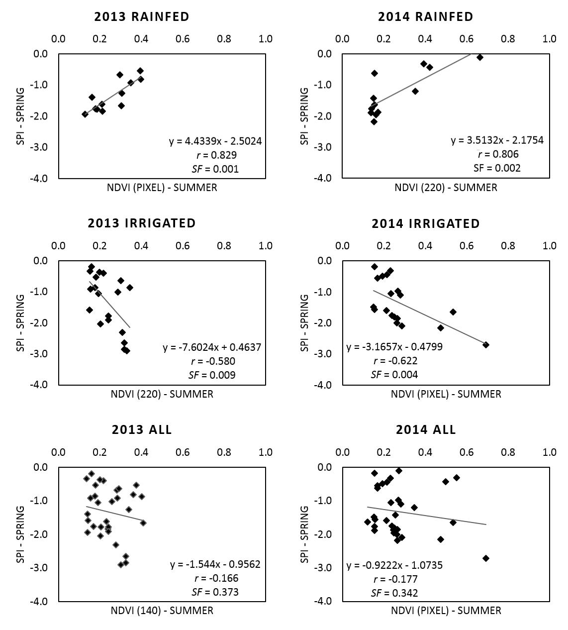
Sample correlations between spring SPI and summer NDVI of 2013 and 2014 for the rainfed, the irrigated and all the areas combined.