A recent submission by Drs. Emre Ozelkan and Gang Chen has been accepted by International Journal of Digital Earth. Congratulations, Emre!
Title: Spatial Estimation of Wind Speed: A New Integrative Model Using Inverse Distance Weighting and Power Law
Abstract:
Spatial interpolation (SI) is currently one of the most common ways to estimate wind speed (Ws). However, classic SI models either ignore the complex geography (e.g., inverse distance weighting (IDW)), or demand high computational resources (e.g., cokriging). This study aimed to develop a simple yet effective SI model for estimating Ws in Eastern Thrace of Turkey. This new method, named MIDW(Ws), is a modified IDW through the integration of IDW with wind profile model, power law (PL), representing the influence of land cover and topography on Ws. Terrain features and elevation data of PL were obtained using normalized difference vegetation index (NDVI) and digital elevation model (DEM), respectively. Results showed superior and comparable performance of MIDW(Ws) to standard IDW and ordinary kriging (OK) across all months of the tested year. Compared to ordinary cokriging (OCK) using DEM as covariate, MIDW(Ws) generated better results in the arid–semiarid seasons (around summer). Local complex atmospheric conditions during rainy seasons (around winter) may have affected the performance of incorporating PL with MIDW(Ws). Generally, the proposed MIDW(Ws) is simpler and easier to implement compared to OCK. For landscape–scale projects, its high computational efficiency and relatively robust performance show potential to deal with large volumes of data sets.
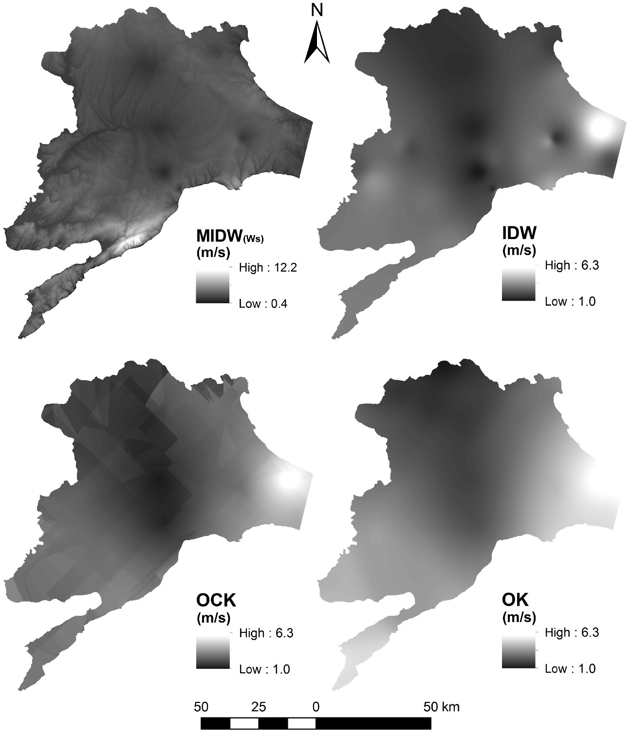
A comparison of wind speed spatial interpolation maps using MIDW(Ws), IDW, OCK, and OK.