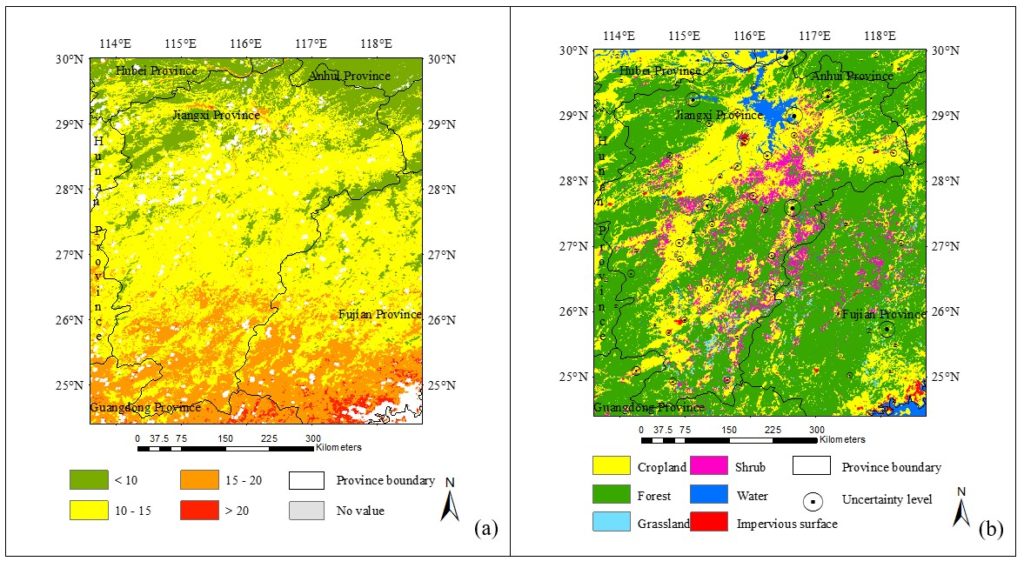
A collaborative study assessing the impacts of land cover and seasonal variation on maximum air temperature estimation was recently accepted by the journal Remote Sensing. This project was completed when Dr. Yulin Cai visited LRSEC.
Abstract:
Daily maximum surface air temperature (Tamax) is a crucial factor for understanding the complex land surface processes under rapid climate change. Remote detection of Tamax has widely relied on the empirical relationship between air temperature and land surface temperature (LST), a product derived from remote sensing. However, little is known about how such relationship is affected by the high heterogeneity in landscapes and dynamics in seasonality. This study aims to advance our understanding of the roles of land cover and seasonal variation in the estimation of Tamax using the MODIS (Moderate Resolution Imaging Spectroradiometer) LST product. We developed statistical models to link Tamax and LST in the middle and lower reaches of the Yangtze River in China for five major land-cover types (i.e., forest, shrub, water, impervious surface, cropland and grassland) and two seasons (i.e., growing season and non-growing season). Results show that the performance of modeling the Tamax-LST relationship was highly dependent on land cover and seasonal variation. Estimating Tamax over grasslands and water bodies achieved superior performance; while uncertainties were high over forested lands that contained extensive heterogeneity in species types, plant structure, and topography. We further found that all the land-cover specific models developed for the plant non-growing season outperformed the corresponding models developed for the growing season. Discrepancies in model performance mainly occurred in the vegetated areas (forest, cropland, and shrub), suggesting an important role of plant phenology in defining the statistical relationship between Tamax and LST. For impervious surfaces, the challenge of capturing the high spatial heterogeneity in urban settings using the low-resolution MODIS data made Tamax estimation a difficult task, which was especially true in the growing season.
