A research paper led by Dr. Chen was recently accepted by Remote Sensing of Environment, which ranks #1 in the field of remote sensing.
Chen, G., Y. He, A. De Santis, G. Li, R. Cobb, R.K. Meentemeyer (in press). Assessing the impact of emerging forest disease on wildfire using Landsat and KOMPSAT-2 data. Remote Sensing of Environment.
Abstract:
Environmental disturbance regimes are more frequently being altered by historically novel events and disturbance interactions, which may trigger reorganizations of new ecosystem states and processes. Here we examine synergies between emerging forest disease and wildfire to determine whether disease outbreak changes environmental drivers of burn severity using sudden oak death and the basin complex fire in California as a case study of novel disturbance interaction. We mapped the spatial distribution of sudden oak death tree mortality using a new object-based filter with 1.0 m resolution KOMPSAT-2 images. We integrated these data with a physical simulation model of burn severity informed by post-fire Landsat data. Model performance varied across stages of disease establishment (early, middle and late) with stronger relationships occurring during later stages of disease progression. Multiscale statistical analysis of environmental drivers of burn severity in diseased compared to healthy forests showed that sudden oak death tree mortality altered relationships between burn severity and the biophysical environment. Specifically, compared to the healthy forests, those affected by disease exhibited higher landscape heterogeneity at smaller spatial scales (e.g., 25 and 50m), which has been associated with decreased burn severity in the literature. Our results showed the opposite pattern. That is, a disease-affected landscape comprising less connected patches and higher patch shape complexity was more likely to experience greater burn severity. This suggests that disease-caused increases in surface fuels may have reduced the landscape’s resistance to fire and in turn increased burn severity in forest patches neighboring disease-impacted forests.
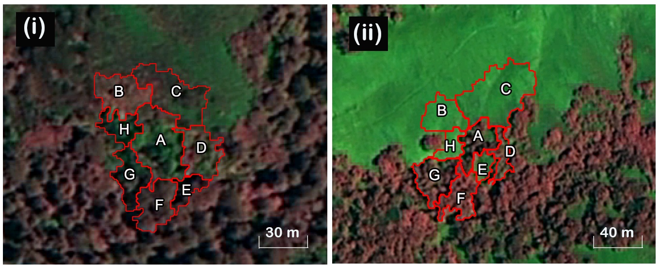
Fig. 1. (i) A disease-impacted forest object A (surrounded by object neighbors B to H), versus (ii) a healthy forest object A (surrounded by object neighbors B to H). The color combinations were NIR-R-B.