Main characteristics of UrbanWatch:
▪ Very high spatial resolution at 1 meter.
▪ Open access (free): https://urbanwatch.charlotte.edu/product.
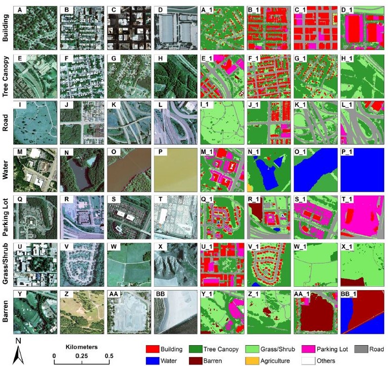
▪ 9 land cover/use types: building, road, parking lot, tree canopy, grass/shrub, water, agriculture, barren, and others.
▪ Overall accuracy of 91.52%.
▪ Coverage of 23 major U.S. cities (more to add).
▪ Peer reviewed and published in the journal Remote Sensing of Environment (ranked #1 in remote sensing, impact factor: 10.164).
▪ Cutting-edge AI deep learning algorithm, trained with over 52 million samples to capture diverse land cover and land use types and urban spatial patterns.
▪ Below please find some examples of various types of land cover and land use (e.g., “A”, “B”, and “AA”) and their corresponding results in UrbanWatch (e.g., “A_1”, “B_1”, and “AA_1”).
