Dr. Chen was recently elected as a BOD (Board of Directors) member of CPGIS (International Association of Chinese Professionals in Geographic Information Sciences). It is a two-year term from 2017 to 2019.
AUTHOR
Gang Chen
Dr. Chen elected as BOD member of CPGIS
Categories: Updates
New GEOBIA paper publish in GIScience & RS
Categories: Updates
Geographic Object-based Image Analysis (GEOBIA): Emerging trends and future opportunities
Gang Chen a, Qihao Weng b, Geoffrey J. Hay c, Yinan He a
a Laboratory for Remote Sensing and Environmental Change (LRSEC), Department of Geography and Earth Sciences, University of North Carolina at Charlotte, Charlotte, NC 28223, USA
b Center for Urban and Environmental Change, Department of Earth and Environmental Systems, Indiana State University, Terre Haute, IN 47809, USA
c Department of Geography, University of Calgary, Calgary, AB T2N 1N4, Canada
Abstract:
Over the last two decades (since circa 2000), Geographic Object-Based Image Analysis (GEOBIA) has emerged as a new paradigm to analyzing high-spatial resolution remote sensing imagery. During this time, research interests have demonstrated a shift from the development of GEOBIA theoretical foundations to advanced geo-object-based models and their implementation in a wide variety of real-world applications. We suggest that such a rapid GEOBIA evolution warrants the need for a systematic review that defines the recent developments in this field. Therefore, the main objective of this paper is to elucidate the emerging trends in GEOBIA, and discuss potential opportunities for future development. The emerging trends were found in multiple sub-fields of GEOBIA, including data sources, image segmentation, object-based feature extraction, and geo-object-based modeling frameworks. It is our view that understanding the state-of-the-art in GEOBIA will further facilitate and support the study of geographic entities and phenomena at multiple scales with effective incorporation of semantics, informing high-quality project design, and improving geo-object-based model performance and results.
New paper accepted by journal Energy
Categories: Updates
A review paper investigating the modeling approaches for urban building energy use was recently accepted by the journal Energy.
Li, W., Y. Zhou, K. Cetin, J. Eom, Y. Wang, G. Chen, X. Zhang (In press). Modeling urban building energy use: A review of modeling approaches and procedures. Energy. doi: 10.1016/j.energy.2017.11.071
Abstract: With rapid urbanization and economic development, the world has been experiencing an unprecedented increase in energy consumption and greenhouse gas (GHG) emissions. While reducing energy consumption and GHG emissions is a common interest shared by major developed and developing countries, actions to enable these global reductions are generally implemented at the city scale. This is because baseline information from individual cities plays an important role in identifying economical options for improving building energy efficiency and reducing GHG emissions. Numerous approaches have been proposed for modeling urban building energy use in the past decades. This paper aims to provide an up-to-date review of the broad categories of energy models for urban buildings and describes the basic workflow of physics-based, bottom-up models and their applications in simulating urban-scale building energy use. Because there are significant differences across models with varied potential for application, strengths and weaknesses of the reviewed models are also presented. This is followed by a discussion of challenging issues associated with model preparation and calibration.
Welcome Lingling Kong (Yunnan Minzu University) to join LRSEC
Categories: Updates
Ms. Lingling Kong will visit our lab for five months. Her research interests are power electronic technology in Smart Grid, renewable energy power generation, grid connected technology, and GIScience in power system.
Welcome, Lingling!
Two visiting scholars join LRSEC
Categories: Updates
We welcome Dr. Fenghua Huang (Yango University) and Mr. Xun Luo (Guangxi Teachers Education University) to join us!
Fenghua will be working on projects related to image analysis using deep learning, while Xun will be completing his Master’s degree in agricultural land use management.
Chase presents at the CRS meeting
Categories: Updates
Today, Chase Hobbs successfully completed his CRS (Charlotte Research Scholar) project and presented his work at the CRS meeting. Great job, Chase!
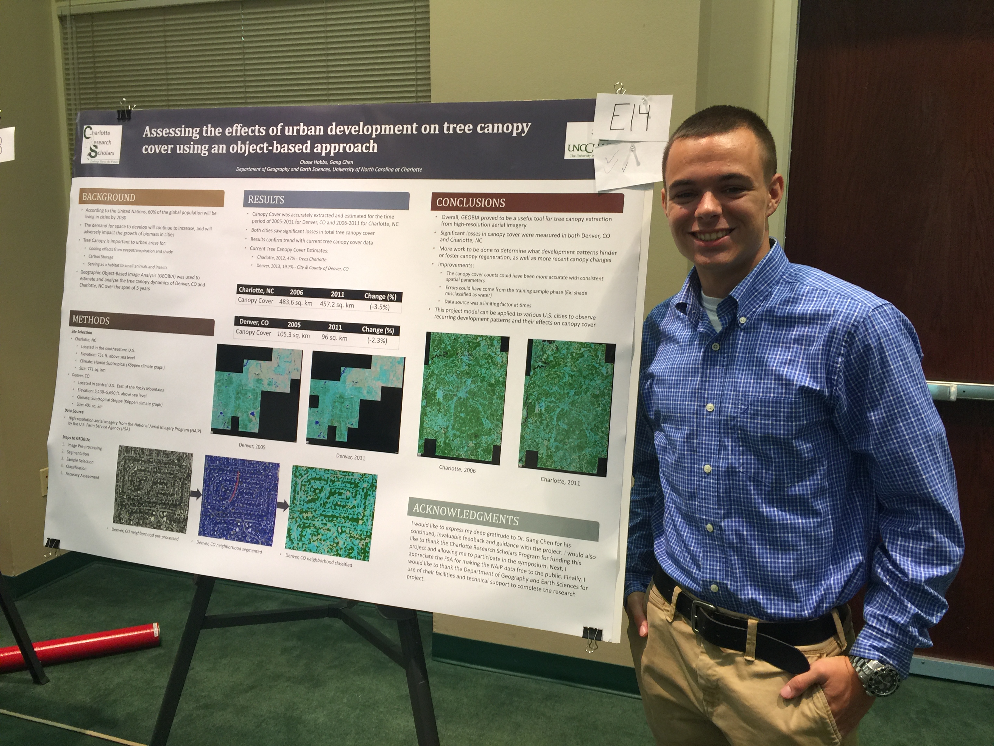
Chase Hobbs Joins LRSEC
Categories: Updates
Chase Hobbs recently joined our lab as a Charlotte Research Scholar (CRS). Chase will work with Dr. Chen and Yinan from May to July to complete a research project aiming to estimate disease-caused tree mortality using remote sensing imagery.
Welcome aboard, Chase!
This is the link to his webpage.
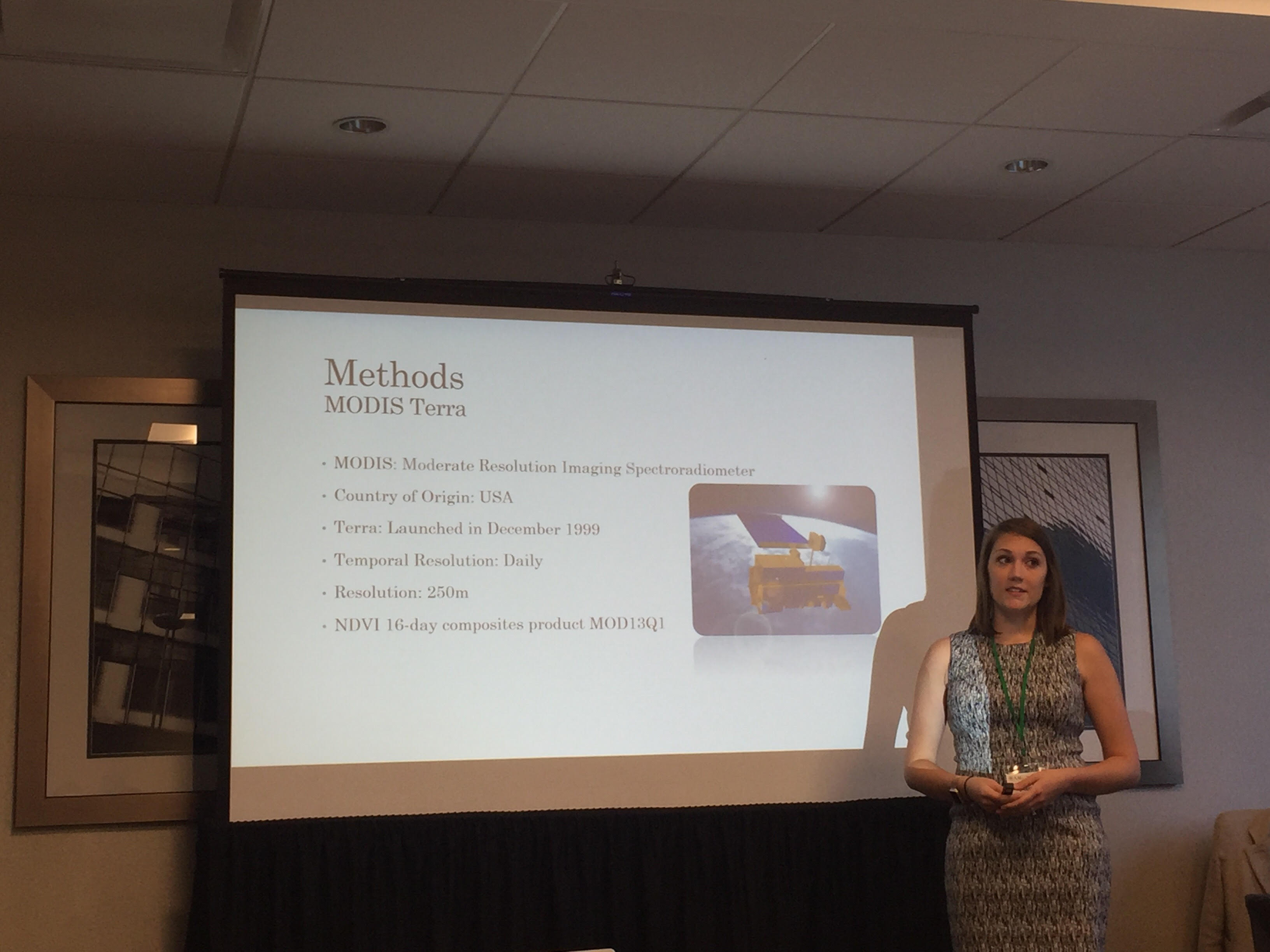
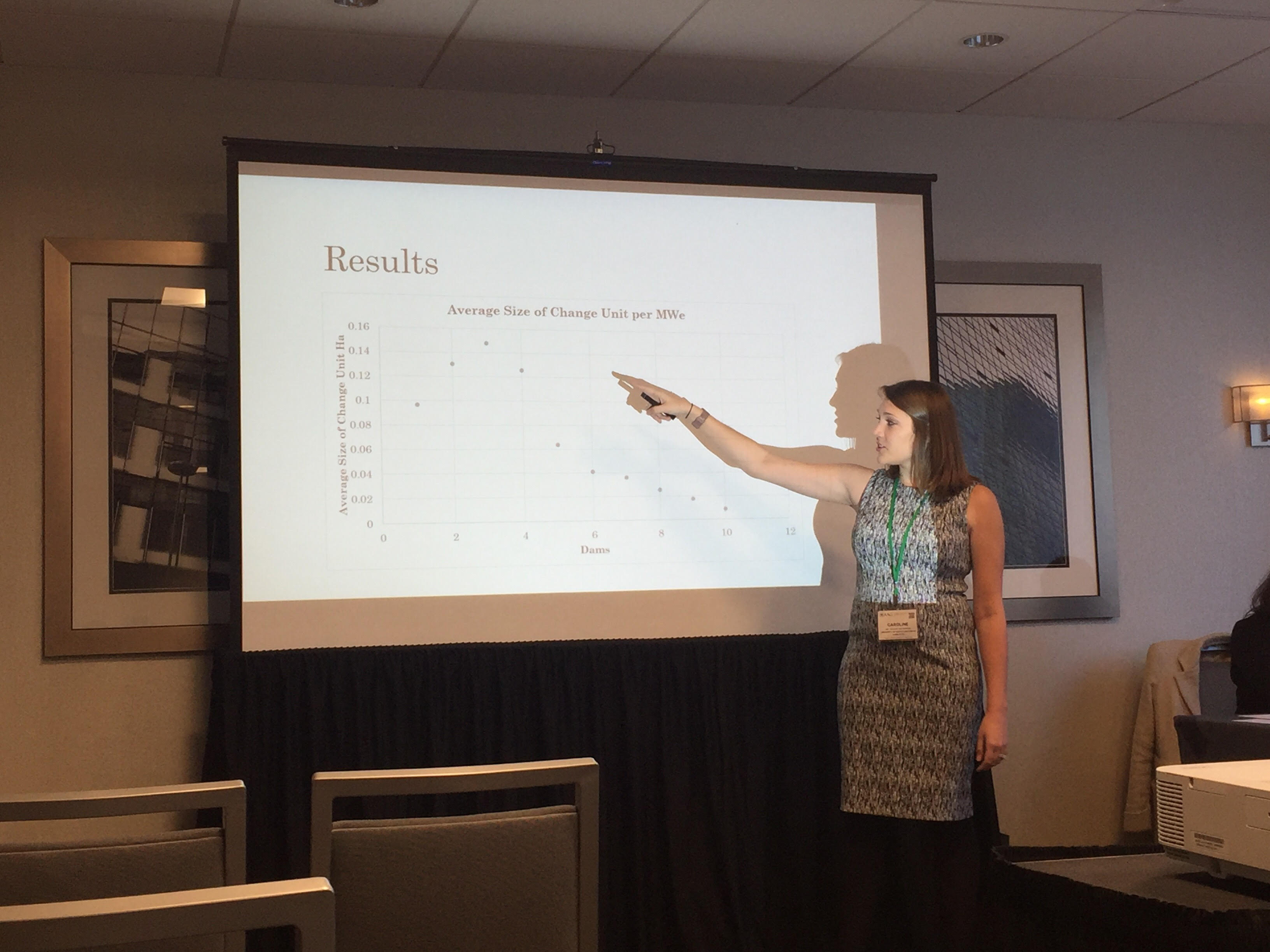
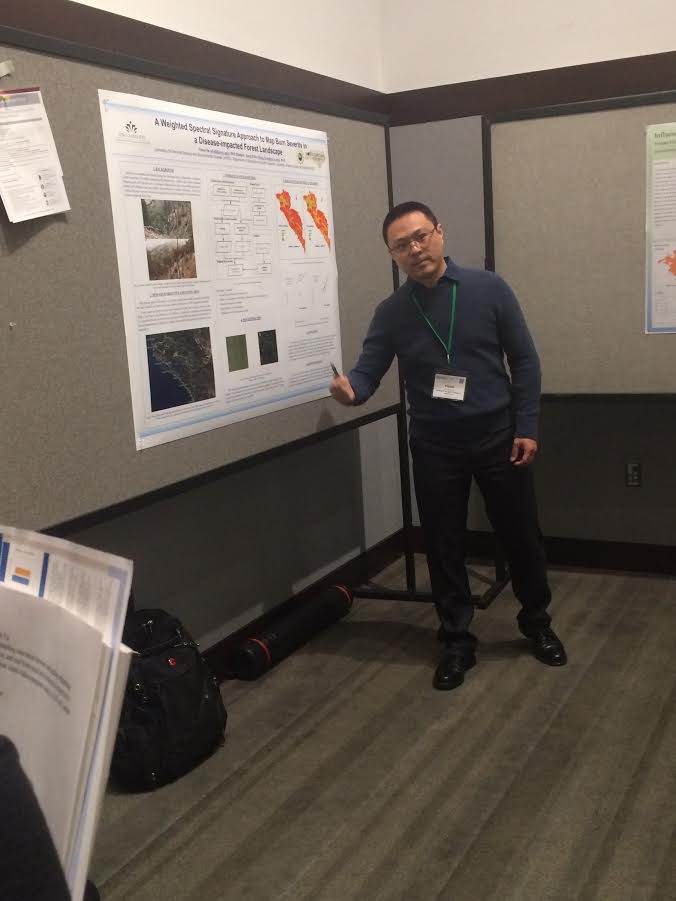
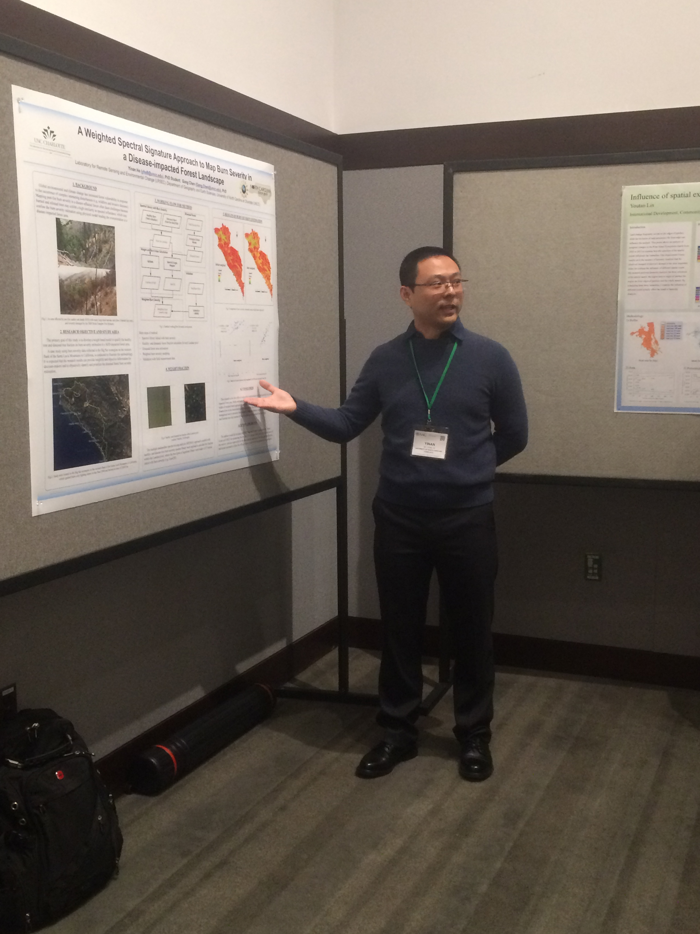
Caroline and Yinan Present at AAG
Categories: Updates
Two lab members Caroline Narron and Yinan He successfully presented at the AAG (American Association of Geographers) annual meeting at Boston in early April, 2017. The presentations stimulated strong interest in the audience.
Great work, Caroline and Yinan!
- Narron, C., W. Sun, and G. Chen (2017). Analyzing the Impact of Hydropower Scale on Tropical Forests in the Brazilian Amazon. American Association of Geographers (AAG) Annual Meeting, Boston, MA, April 5-9.
- He, Y., and G. Chen (2017). A Weighted Spectral Signature Approach to Map Burn Severity in a Disease-impacted Forest Landscape. American Association of Geographers (AAG) Annual Meeting, Boston, MA, April 5-9.
Caroline Narron at AAG (1)
Caroline Narron at AAG (2)
YInan He at AAG (2)
YInan He at AAG (1)
Research paper accepted by Remote Sensing of Environment
Categories: Updates
A research paper led by Dr. Chen was recently accepted by Remote Sensing of Environment, which ranks #1 in the field of remote sensing.
Chen, G., Y. He, A. De Santis, G. Li, R. Cobb, R.K. Meentemeyer (in press). Assessing the impact of emerging forest disease on wildfire using Landsat and KOMPSAT-2 data. Remote Sensing of Environment.
Abstract:
Environmental disturbance regimes are more frequently being altered by historically novel events and disturbance interactions, which may trigger reorganizations of new ecosystem states and processes. Here we examine synergies between emerging forest disease and wildfire to determine whether disease outbreak changes environmental drivers of burn severity using sudden oak death and the basin complex fire in California as a case study of novel disturbance interaction. We mapped the spatial distribution of sudden oak death tree mortality using a new object-based filter with 1.0 m resolution KOMPSAT-2 images. We integrated these data with a physical simulation model of burn severity informed by post-fire Landsat data. Model performance varied across stages of disease establishment (early, middle and late) with stronger relationships occurring during later stages of disease progression. Multiscale statistical analysis of environmental drivers of burn severity in diseased compared to healthy forests showed that sudden oak death tree mortality altered relationships between burn severity and the biophysical environment. Specifically, compared to the healthy forests, those affected by disease exhibited higher landscape heterogeneity at smaller spatial scales (e.g., 25 and 50m), which has been associated with decreased burn severity in the literature. Our results showed the opposite pattern. That is, a disease-affected landscape comprising less connected patches and higher patch shape complexity was more likely to experience greater burn severity. This suggests that disease-caused increases in surface fuels may have reduced the landscape’s resistance to fire and in turn increased burn severity in forest patches neighboring disease-impacted forests.
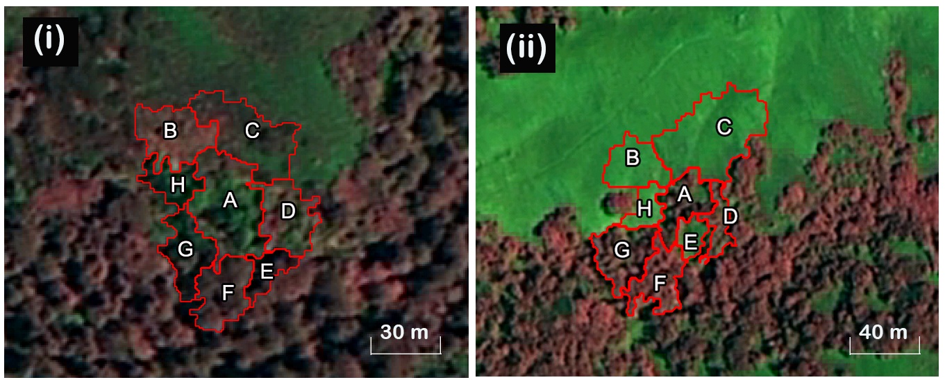
Fig. 1. (i) A disease-impacted forest object A (surrounded by object neighbors B to H), versus (ii) a healthy forest object A (surrounded by object neighbors B to H). The color combinations were NIR-R-B.
Paper accepted by journal Remote Sensing
Categories: Updates
A collaborative study assessing the impacts of land cover and seasonal variation on maximum air temperature estimation was recently accepted by the journal Remote Sensing. This project was completed when Dr. Yulin Cai visited LRSEC.
Abstract:
Daily maximum surface air temperature (Tamax) is a crucial factor for understanding the complex land surface processes under rapid climate change. Remote detection of Tamax has widely relied on the empirical relationship between air temperature and land surface temperature (LST), a product derived from remote sensing. However, little is known about how such relationship is affected by the high heterogeneity in landscapes and dynamics in seasonality. This study aims to advance our understanding of the roles of land cover and seasonal variation in the estimation of Tamax using the MODIS (Moderate Resolution Imaging Spectroradiometer) LST product. We developed statistical models to link Tamax and LST in the middle and lower reaches of the Yangtze River in China for five major land-cover types (i.e., forest, shrub, water, impervious surface, cropland and grassland) and two seasons (i.e., growing season and non-growing season). Results show that the performance of modeling the Tamax-LST relationship was highly dependent on land cover and seasonal variation. Estimating Tamax over grasslands and water bodies achieved superior performance; while uncertainties were high over forested lands that contained extensive heterogeneity in species types, plant structure, and topography. We further found that all the land-cover specific models developed for the plant non-growing season outperformed the corresponding models developed for the growing season. Discrepancies in model performance mainly occurred in the vegetated areas (forest, cropland, and shrub), suggesting an important role of plant phenology in defining the statistical relationship between Tamax and LST. For impervious surfaces, the challenge of capturing the high spatial heterogeneity in urban settings using the low-resolution MODIS data made Tamax estimation a difficult task, which was especially true in the growing season.
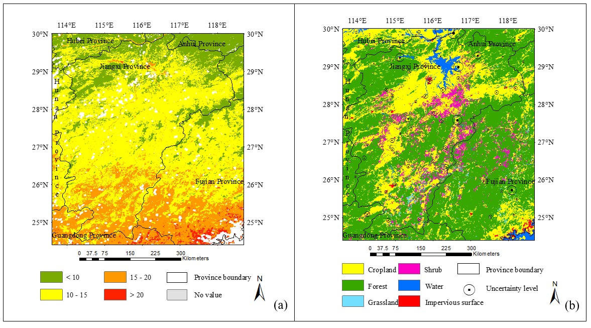
Spatial patterns of the estimated Tamax (a) on Dec 31, 2010, and the corresponding uncertainties at the stations (b). The level of uncertainty is represented by the size of circle.