
Amazing what a team of scientists, techs, and a pile of data will bring you. I tried to embed a great map interface by the group at Climate Central here, but it didn’t work so here’s a screenshot of the information the interactive map provides when you zoom into one of the large fires affecting the USA right now (this one near Los Alamos, New Mexico).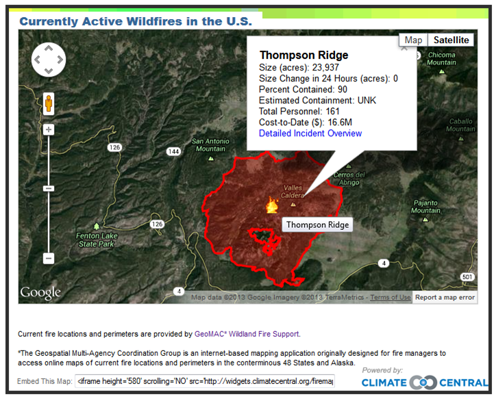 Go to their widget here or to the more detailed posting about the widget here. Essentially, Climate Central is posting updated USA (or maybe North America) fire locations with really useful (and frightening) details as they roll in from daily reports by fire and land managers. Respect and praise for this great product of the intersection between science, technology, and public outreach. I wish the fire crews the best as they battle against an unforgiving enemy.
Contact Me
Brian Magi
brian dot magi at charlotte dot edu
Email is the best way to contact me. My office is McEniry 232, and my mailing address is below.
Geography and Earth Sciences
UNC Charlotte
McEniry 331
9201 University City Blvd
Charlotte, NC 28223-0001Meta


