Product 1: UrbanWatch: A 1-meter resolution land cover and land use database for major cities in the United States
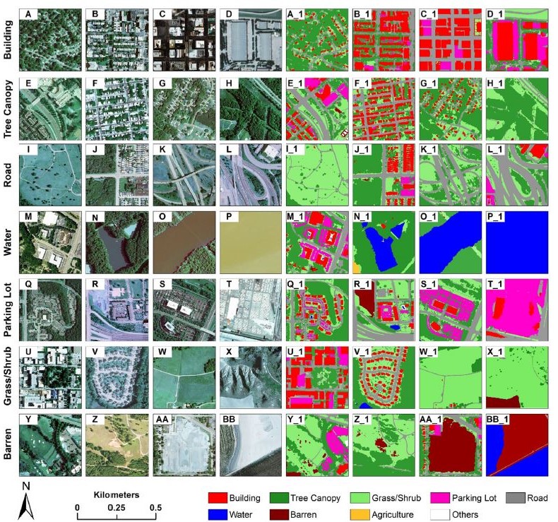
UrbanWatch is a 1-meter resolution, open-access land cover and land use (LCLU) database for major cities across the conterminous United States. UrbanWatch contains 9 LCLU classes, i.e., building, road, parking lot, tree canopy, grass/shrub, water, agriculture, barren, and others, with an overall accuracy of 91.52%. The data are open access through: https://urbanwatch.charlotte.edu/. A paper describing the details about UrbanWatch has been published in Remote Sensing of Environment.
Zhang, Y., Chen, G., Myint, S.W., Zhou, Y., Hay, G.J., Vukomanovic, J., & Meentemeyer, R.K. (2022). UrbanWatch: A 1-meter resolution land cover and land use database for 22 major cities in the United States. Remote Sensing of Environment, 278: 113106.
——————————————————————————————————————–
Product 2: Shadow Semantic Annotation Database (SSAD)
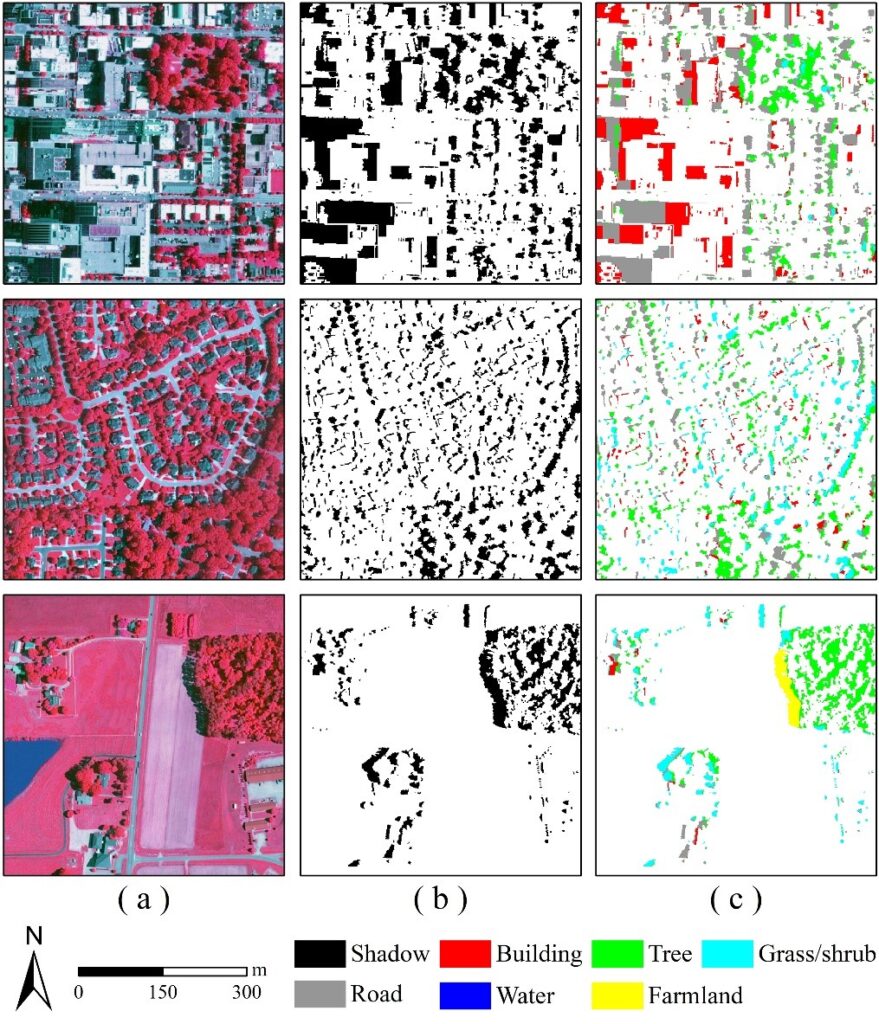
This database was developed for extracting fine-scale land cover in shadows from high-resolution remote sensing imagery. It comprises 103 image patches (500×500 pixels per patch, 1.0-meter resolution) containing various types of shadows and six major land-cover classes – building, tree, grass/shrub, road, water, and farmland. A paper describing the details about the SSAD and the use of this database has been published in Remote Sensing of Environment.
Zhang, Y., Chen, G., Vukomanovic, J., Singh K.K., Liu, Y., Holden, S., & Meentemeyer, R.K. (2020). Recurrent Shadow Attention Model (RSAM) for shadow removal in high-resolution urban land-cover mapping. Remote Sensing of Environment, 247, 111945.
The database is freely accessible (click HERE).